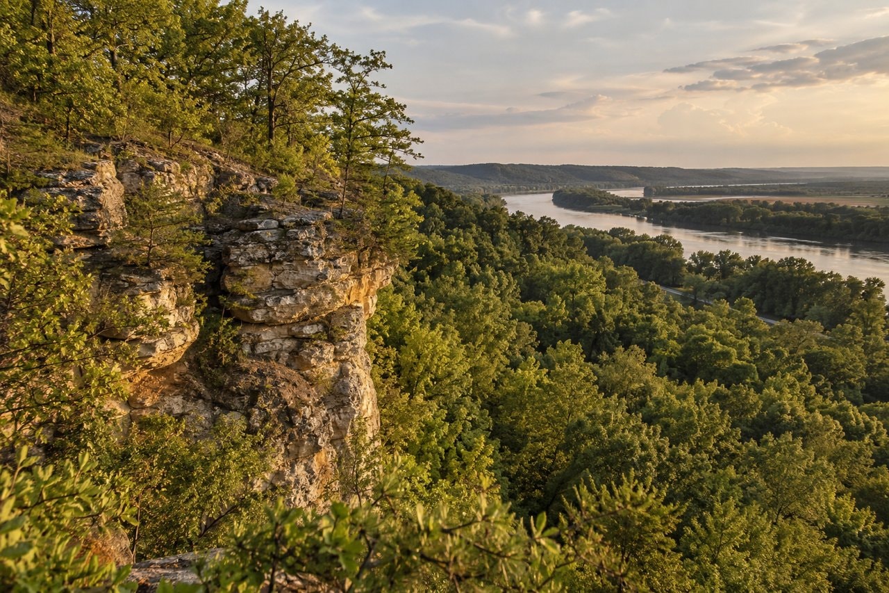
Fountain Bluff is a hill country interruption in the Mississippi floodplain. Sandstone cliffs, wooded slopes, springs and rock shelters stand beside a river landscape whose broad flats give the rise its distinctive setting. Wikipedia's Fountain Bluff account places it in western Jackson County, between Gorham and Grand Tower. It describes an isolated range of hills on the river's east bank, shaped in its unusual position by Ice-Age changes to the valley.
The river changed the setting
The account explains that Fountain Bluff was once connected with the west side of the Mississippi valley. During glaciation, meltwater and a blocked river channel drove the Mississippi into a different course. When the ice withdrew, the hill remained isolated in the valley. During heavy meltwater periods it could be surrounded by water. That history explains why a substantial rocky rise occupies a setting that otherwise reads as floodplain.
Wikipedia describes limestone beneath sandstone, with sandstone forming most of the visible exposed layers. Erosion by the Mississippi shaped the western and southern cliffs. Springs, streams and waterfalls also figure in the account, and natural springs gave the bluff its name. Geology here is not simply a list of rock types: it is part of the reason that cliffs, sheltered hollows and flatter river ground occur so close together.
Most of the hill is described as part of Shawnee National Forest, with some private land. Those different ownerships should not be blurred into an assumption of unrestricted access. The walking the hills feature considers what steep regional terrain asks of walkers. The existence of a hill in a forest landscape does not make every rock shelter a public destination.
Several plant settings on a hill
The Fountain Bluff article lists floodplain woods and swamps, woods on shallow limestone soils, moist woods, exposed hill prairies and cliff faces among its plant communities. Those are distinct settings for roots, moisture and exposure. A species that suits a shaded hollow may not belong on the exposed top. The variety helps explain why the hill's biodiversity is discussed alongside its striking outline.
The article also records northern harebell growing well south of its usual range and suggests that it may have become established during glaciation. That is a reported possibility, rather than a date that can be read from a present flower. The hill's isolation is described as important to its unusual plants and animals. Notice how much of that account concerns the setting, not just a list of species.
Carved rock is a record, not an invitation
Wikipedia reports that archaeologists believe Fountain Bluff's petroglyphs were carved between 1000 and 1250 AD. It also says that some carvings are believed to relate to ceremonial activity around the spring equinox, and describes a further site in Trestle Hollow as a solstitial observatory. Those associations remain attributed interpretations. The ancient astronomy feature explains why a seasonal alignment and a claim about meaning require different evidence.
The petroglyph sites described at Fountain Bluff are on private land and are not open to the public. Wikipedia's account explicitly states that access limit and records damage and vandalism. No direction to a carving is needed to understand its historical importance. A closed site can be discussed respectfully without turning it into a route to follow.
Wikipedia defines a petroglyph as an image made by removing part of a rock surface through cutting, picking, carving or abrasion. Its rock-art account places such work beside paintings and other marks on natural surfaces. The distinction helps describe the material evidence without assigning a particular meaning to every shape.
The regional comparison in Wikipedia's Piney Creek Ravine account records Native American petroglyphs alongside modern graffiti. That juxtaposition is a reminder that later damage becomes part of what survives on a surface. Respect access limits and leave rock surfaces unchanged. The aim is to understand a record, not to add another mark to it.
People and work beside the bluff
The Fountain Bluff article places Kaskaskia people in the area during early European settlement and describes the federal relocation of their community to Kansas. It then describes immigrant settlement around the bluff. These changes belong to the place's human history. They should not be reduced to a timeless scenic backdrop or treated as though the river landscape had no communities before later settlement.
The same source records excursion travel by the Illinois Central Railroad and, during the Depression, Civilian Conservation Corps work involving roads, bridges and other construction. Sandstone was quarried for projects, and the corps built a fire lookout tower. That history joins the rock itself with practical work on the surrounding landscape. For the wider Indigenous agricultural and ceremonial setting, read the Mississippians of the American Bottom.